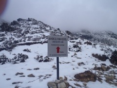
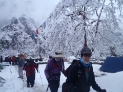
Pheriche and 14,300 feet
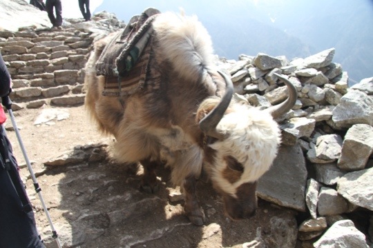
After our blessings from the Lama Geishe, we made our way with sunny skies to Pheriche and another rest day. A long the way, we meet with Yak herds, Trekkers and climbers.
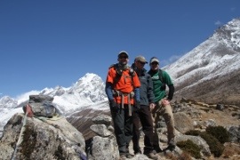
In particular, we’ve been pacing with the first American to climb Mt. Everest, Jim Whitaker and his Eddie Bauer “First Ascent” team that includes 13-time summiter, Dave Hahn. Whittaker is celebrating the 50th anniversary of his summit while supporting Hahn in his push to log yet another – all supported by the good folks at First Ascent.
There are a number of commercial ventures up on Everest this year including the North Face, National Geographic, Prince Harry and the broad assortment of groups like ours from all over the world.
But some of the most incredible people are the ones who donate portions of their time, money and effort here for the locals. Among those, the Himalayan Rescue Foundation is one that dedicates the time of doctors here to help locals and travelers alike.
But now, Journey is cranking in the tea house and the wifi is cranking while the wind and snow pound against the windows. It all serves to remind me that I’ll be sleeping in a tent at over 16,000 feet tomorrow – with no wifi.

April 6, Blessings on the Way to Pheriche
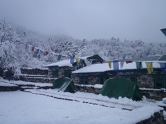
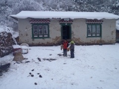
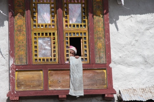
We awoke to over four inches of snow. It could have been a l-o-n-g slog to Pheriche, except we have a great group. And, along the way, Heidi one of our climbers, handed out puppets and stuffed animals to two small children that we met along the way.
We made our way ups the Dodh Kosi river; a deep green color of green, like eyes. The color of green, I’m told, that means hope.
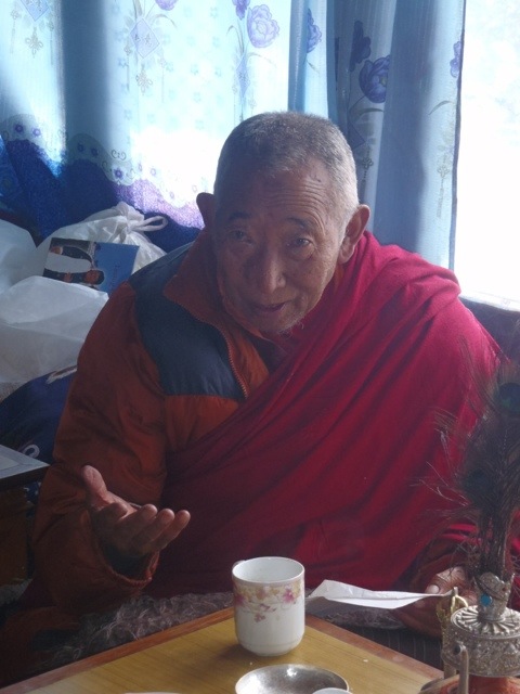
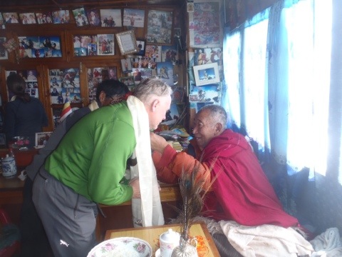
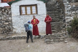
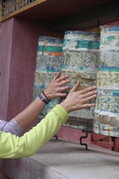
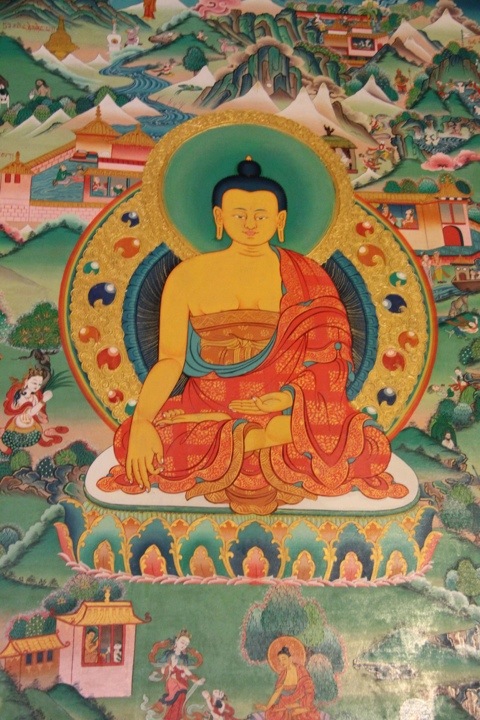
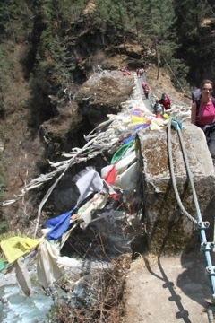
At the Pangboche monastery, we received our blessings from the Lama Geishe, and had our Katas (scarves) blessed. And, funny, when we stepped out side the sun came out…
Geishe asked us all to “Give up all intentions to harm others for your heart
And do your best to benefit them all.
If each and everyone feels the universal responsibility to do so,
We will all enjoy the feast of Peace!”
Namaste!

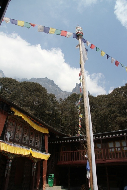
At Tyengboche monastery.
On our rest day at Bengaboche, we hiked up to visit the Tyengaboche monastery.
It was a beautiful day as clouds rolled in adding to the ancient mysticism of such an incredible place.
Namche to Dengboche
The trek from Namche Bazar was a fair, warm day.
We hiked in the Khumbu valley with each turn revealing yet another incredible view. About two thirds of the way into the hike’ we descended to the Dodh Kosi river for lunch. From there, it was a 2,000-foot hump to 12,732 feet and the Thyangaboche monastery.
Nothing like gaining vertical at altitude!
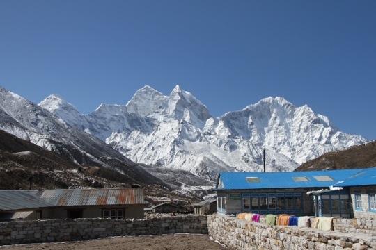
We quickly descended to Dengboche where we stayed at the Rivendale lodge. Jim and I thought we’d drawn the short straw when the guides didn’t know where are room was. But, after a quick inspection, we found that our room had its own SHOWER with a toilet with TOILET PAPER!!!
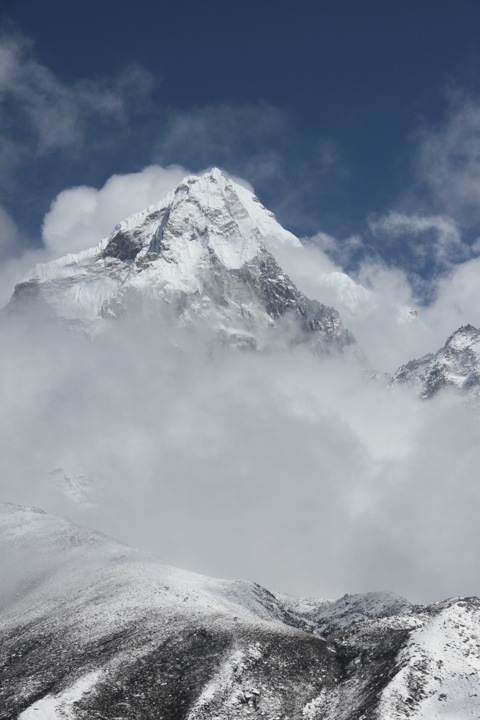
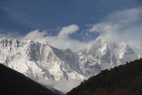
There were also great views of Everest and Ama Dablam…
The First View
IMG wisely adheres to the motto, go slowly to the top. We would be spending three days in Namche. Today, though, we went to the Khumjung Gompa. A Gompa is a fortified place of worship for Buddhists. And, given how the Tibetans are being treated in China, it sounds like a good idea.
The hike took us straight up out of Namche to over 12,000 feet where we got to see the world’s highest airstrip, and then ambled on to the Everest View Hotel. Another 70 F day, with beautiful views of Mt. Everest.
We met Russell Brice of “Surviving Everest” fame, and our head climbing Sherpa – a way more important person in my book!
A day on a dusty trail ended with a great view of Namche.

Phakding to Namche Bazar
Leaving Phakding for Namche, April 1, 2012
We were in the trail by 8 since the trail to Namche Bazar, at 11,352 feet, would be one of our longest, and have the most vertical gain of our travels up the Khumbu valley.
Shortly before I left, I had decided to check into nailing down a new pair of approach shoes. While climbing with my good friend and AMGA Board Member Kyle Lefkoff, I noticed that he was wearing a pair of La Sportiva Gandes – and he really liked them. Before climbing Aconcagua, I took a pair of La Sportiva Lhotses and wore them almost out of the box to the summit. In fact, Sportiva pretty much fit my feet like I’m their shoe model. I’ve never invested in Sportivas and been disappointed. Gande Guides it would be!
Another important item for caring for one’s health on an extended expedition, along with great footwear, is being sure to replace essential minerals and vitamins along the way. On an approach that will last up to a week, vitamins and electrolyte replacement are crucial elements in maintaining one’s health and feeling strong. For a trip of this magnitude, we chose ThermoBoost from SlimGenics. Loaded with B vitamins, amino acids and guarana, ThermoBoost has been proven to help increase oxygen uptake – a crucial feature for us as we move higher.
Our day-long hike was uneventful and the weather was beautiful. The only cause for concern was a fire down in the Khumbu that created a layer of smoke chilling any scenic shots.

On to Lukla
Flight to Lukla March 31, 2012
After two days of breathing the pollution and absorbing the noise, it was time to hit the trail.a
We were rolling by 4:30, debut I was still the last person out with my duffle bag. Head guide Eric Simonson’s eyes bugged out since the bags had left 45 minutes prior.
I had become that guy…
At the airport, things moved with third-world smoothness and we were loaded on to a Twin Otter plane headed for Lukla. I kept telling myself not to look at the interior as a way to gauge how well the plane had been maintained. Or we would be in a lot of trouble.
The flight went off with the accustomed third world smoothness. It wasn’t until I saw the runway that we realized that life in Nepal was not only efficient, but effective. Looking through the cockpit windshield, you could see the airport – built into the side of hill dead- ending into stone wall. The strip itself, was a wide swath that angled up at a 10-15 degree slope to aid in slowing down landing planes, as well as help launch planes on take off. At an elevation of 9372 feet, the air is thin for planes (and humans) requiring a bit more umph for old, overloaded and underpowered planes.
It was still unnerving though you knew that this had been done at least 20 times or so without incident.
On the Road
Everyone has been so incredible this past week. I’ve been humbled and flattered by the well wishes I’ve been receiving in the run up to my departure to Katmandu and Mt. Everest.
In fact, I’ve been dealing with so much detail that it’s been almost impossible to get a full grip on the enormity of the trek until I’m doing something mind-numbing like counting out vitamins for 60 days.
One thing that has been ever-present, and a real bedrock to the entire effort, is the undying support of my wife, Dianne. No matter how hard I whine, she has always been there to slap me around and remind me what and why I’m doing. It must be why we’re celebrating our 12th anniversary on our deck drinking the sparkling wine (J’s Cuvee 20) that we served at our reception.
But, more about the trip!

A day over the International Dateline, and about 20+ hours of air travel get one to Katmandu from Boulder.
Folks have asked me, how long does it take to get there? Well, when you’re flying halfway around the world, it takes about 20+ hours and a day when flying west over the International Dateline when you’re going to K-k-k-k-katmandu.
From Katmandu, we take a short flight to Lukla on Friday, hike about five miles of the 40-mile trek to Everest Base Camp. Along the way we’ll be staying in tea houses, visiting monasteries, and acclimatizing. Lukla is at 9,000 feet.

On the way, will spend a few nights acclimatizing in the Lobuche Valley at 16,000. From there, we will make a trip or two up to Everest Base Camp at almost 18,000-feet in preparation for an acclimatization climb of Lobuche Peak, 20,000+.

Once we’ve climbed Lobuche, we move up to Everest Base Camp and start working our way up the Big Hill.
The first challenge will be working our way through the Khumbu Ice Fall. I’ll post some photos as we work our way through, but this is the first place people begin to lose their shit. In order to move up through this huge jumble of glacier terminus, it requires some ice climbing skills, and being comfortable walking across ladders while wearing those spikes on one’s boots called crampons. Metal on metal, over huge open and seemingly bottomless crevasses. If you haven’t climbed anything in your life with significant exposure, this sort of climbing can create a “puckering” experience for some.
In the picture of the Khumbu, you’re looking at 2,000+ vertical feet of ice blocks the size of skyscrapers and boxcars.
 A shot of the Khumbu that gives an idea of how many crevasses there are to cross.
The part that I’m dreading is the Lhotse face. From Camp 2, it’s about 2,500 feet of climbing up high-angle ice and snow to Camp 3 at 24,500 feet. Here we will be using a veritable hand-rail, or fixed rope, using ascender devices that allow you to slide them up the rope, but not slide down. The tedium here is like being in the early second quarter of a marathon. You’re just slugging it out, doing your best to breathe, and there is seemingly no end it sight. My second least favorite part of the climb. The other is climbing in the dark. Both require a lot of mental tenacity.
From Upper Camp 3 we will move up to Camp 4, or the South Col made famous in Jon Krakauer’s book, “Into Thin Air.” On oxygen, we’ll only be on the South Col long enough to hydrate, eat, nap and then make the last push to the summit. In order to get ahead of slower moving teams, we’ll start at 10 pm. I hate climbing at night, but it will allow us to stay ahead of any bottlenecks that can cause a lot of standing around and getting cold. Once again, if one isn’t accustomed to what climbers refer to as “exposure,” there will be a lot of standing around as one waits for those in front to gather their nerve. I should point out, once on the summit ridge of Everest, or what the Sherpas refer to as Chomolungma, there is a near vertical drop to the north of 10,000 feet into China, and a drop of about 8,000 vertical feet back into Nepal, as you try to negotiate a path less than the width of ones shoulders. But there are fixed lines in place.

As I was telling a friend of mine while climbing this weekend, you just look where you’re putting your feet. Never look down unless you’re looking out over the horizon!
Once on the summit, and a few flags have been flown and some satellite calls made, it is a boogie sprint back to Camp 2, almost 7,000 feet of descent. A full day by any climbing standard. Some minor celebration will be happening here.
From Camp 2, it’s back to Base Camp and some major celebration. After a few days rest, the 40 mile trek back to Lukla and our flight to Katmandu. After a a few more
According to our itinerary, we should be summiting on May 17 and back in Katmandu on the 24th where, I’ll be meeting up with that incredible woman I was speaking about earlier. Dianne will be meeting me at none other than the famous Yak and Yeti hotel. From there, we’ll go out and enjoy the sites that I was too uptight to enjoy when I was in Katmandu on the way in to meet the Goddess Mother Earth, Chomolungma. I hope to feel the Goddess’s love!

Sometimes the Summit is Easy
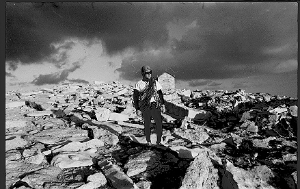
A great Fall climb with a friend that became an epical descent. Bob on the summit of Mt. Whitney, California, 14,595 feet.
The great American mountaineer Ed Viesturs once said, “Getting to the summit is optional; getting down is mandatory.”
Well said, but when you’re so focused on the summit of a peak, that bit of detail can sometimes be overlooked.

My partner, Cathy Gildea, thought it might be a Fall adventure to climb the 3,000-foot east face of Mt. Whitney, the tallest mountain in the lower 48. Though not technically difficult, the location, size and height require some fairly competent mountain skills. The plan called for a ten-mile approach to the base of the mountain – including bushwhacking through some stubborn willow fields.
Cathy and I made to the base of Whitney in pretty good time and were able to set up our camp and enjoy the evening. Cathy and I had been climbing together for about five years and had been through a number of great ice climbing, mountaineering, rock climbing and fly fishing adventures, but this was our biggest peak together. We had both climbed Denali prior to Whitney, and she had even summited Aconcagua – a peak that I didn’t summit until 2008.
How hard could it be?

Other than the high altitude – for sea-level, Silicon Valley types – the climbing was moderate to easy. We hit it early, slept well and got on the mountain just after first light. We had water and snacks and were looking forward to a great day.

We made good time on the East Face, uncharacteristically finding the right route and staying on it. We were cruising through most of the climb until we got caught behind a slow party. Trying to be conscious of time, I bypassed them on a much more difficult but parallel route. At this point, leading a difficult crack at over 14,000 feet seemed like the logical thing to do.
How hard could it be?
My confidence came from that fact that Cathy was ever the watchful belayer. It’s what makes her a great Mom to two young lads these days.
Still panting like a dog at my belay, I brought her up and we continued the regular route ahead of our other climbing friends. But the day was slowly, but surely, taking it’s toll.
Cathy had taken some ibuprofen for various aches and pains that morning and was trying NOT to drink any water for fear of slowing us down. It seemed like a good idea at the time.
But, as we continued to climb into the warm Fall afternoon, she began to get dehydrated.
We moved quickly over some of the easier ground and soon found ourselves on the summit and heading for the descent route known as “The Mountaineers Gully.” We hit the gully with rapidly vanishing daylight, feeling home free with only a 2,000-foot descent ahead of us, when Cathy grew ill and began vomiting.
About every 10 to 20 minutes, she would have to stop and expel. Darkness quickly over took us, and the night began to grow grim. Being in the gully, we had no moonlight. Even the beam of my headlamp was being consumed by the dark. At one point, we came to edge of a 200-foot cliff that we only knew was there because we could feel the updraft.
Still, we struggled onward and downward for hours until we reached a small tarn at the base of the mountain. Still 30 minutes for our camp, we drank deeply from the small lake figuring that it would take Giardia a few days to catch us. As she drank, Cathy began to feel better and we both learned a lesson about ibuprofen, hydration and big mountains that day.
We were happy to watch the moon rise another night from the comfort of our sleeping bags.

You must be logged in to post a comment.